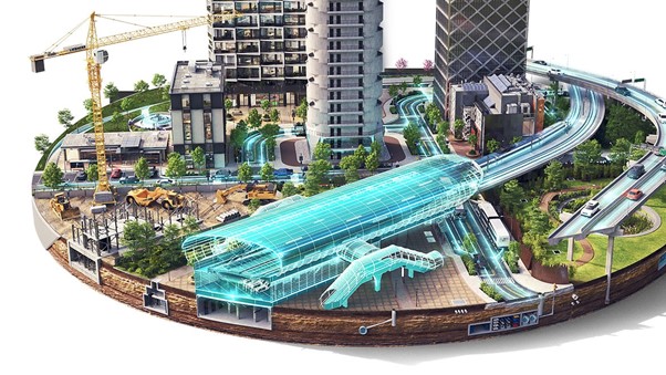
“Digital Twin” technology is emerging as a powerful tool in modern urban governance, providing an accurate virtual simulation environment to replicate and test land-use policies in complex urban spaces. A digital twin comprehensively integrates population data, technical infrastructure, and environmental factors into a unified virtual modeling system. In terms of simulation capability, Digital Twin enables scientists to comprehensively assess the environmental impacts of an urban planning project within less than 24 hours. This technology supports the optimization of approximately 20–30% of public land through precise simulation of population density and infrastructure allocation (Fuller et al., 2020).
In particular, through dynamic simulation, Digital Twin allows planners to evaluate surface temperature and optimize green spaces, contributing to the reduction of the urban heat island effect by 2 to 4°C. Beyond visualization, Digital Twin enhances community participation in the decision-making process through interactive interfaces, ensuring transparency and balancing economic development with environmental conservation. Continuous data updates from urban sensors ensure that the virtual model accurately reflects the real-time status of land resources and infrastructure. This is a key solution for developing smart cities capable of flexibly adapting to climate change and increasing population pressures. Digital Twin not only reduces investment risks but also establishes a foundation for evidence-based urban planning, enabling policymakers to make more accurate decisions in land resource management (Pan & Zhang, 2021).
Authors: Hao Phu Dong, Binh Thanh Nguyen*
References:
Fuller, A., Fan, Z., Day, C., & Barlow, C. (2020). Digital twin: Enabling technologies, challenges and open research. IEEE access, 8, 108952-108971.
Pan, Y., & Zhang, L. (2021). Roles of artificial intelligence in construction engineering and management: A critical review and future trends. Automation in Construction, 122, 103517.


ⓒ 2026 BICE | Biochar-based Integrated Circular Economy for Paddy Rice.